Summary
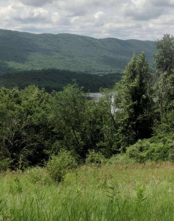
A small number of trails with an enjoyable mix of woods and open areas, with nice views of the mountains. Some trails are steep and can be slick when muddy. Horseflies are sometimes quite bad.
This is a first draft of a horse riding guide for Canoe Creek state park outside Hollidaysburg and Altoona, Pennsylvania.
There isn’t a lot of horse trail mileage, maybe 10 miles, and some of the trails are fairly steep, but it’s a nice park in general. There are several potential trail loops, which is nice.
Parking
The main designated horse trailer parking spot is fields on the RIGHT side as you come in the main entrance road and face the 6 big parking lots at the beach. Older maps show it on the opposite side.
Note that a “disc golf” course goes along the side of this field. Users get grumpy if you intrude on them, and there seem to be way too many of them. If you park in the center of the field you have no shade, but you are away from the disc-heads and the road. Some people drive awfully fast considering this is a park!
According to the park map, you can also park at the cul-de-sac at the end of Mattern Road, but it’s a pretty small area and the website does not mention it.
Equestrian Trail Areas
Designated horse trails are mostly in the north/northeast corner of the park.
There is no easy way to get from one side of the lake to the other. If you want to ride the new trail connection from the park to the Lower Trail (nearby rail trail), you could park on the east shore of the lake. But then you can’t get to the park’s own horse trails! And note that you still have to ride on public roads for some distance to connect to the Lower Trail.
An improved connection between areas of the park and the Lower Trail is supposedly in the planning stage (2022).
Loop Trails
There are a number of looping options. Since all of these climb up and down Moore’s Hill, you are looking at 530-600 feet of vertical distance.
Mattern Trail is the western loop. It is quite steep in places. Our preferred direction is to climb up behind the historic lime kilns, as it is a bit muddy and not the easiest to come down. The climb is long and hard (1/4 mile of ~25%), and there is not much space to take a break part way up. The only good thing we can say is that somebody was smart enough to put mounting blocks and benches at the top of the hill! You will probably need it to check your girth after this climb.
On the other side of the loop you have to come back down an equal slope. It’s a bit rocky but doesn’t seem so muddy and slippery, probably because it gets more sunlight.
Map and profile of Mattern Trail loop (~3 miles) ![]()
Mattern + Moore’s Hill combines the western and eastern loops. We have not tried Moore’s Hill yet. The east side is supposedly pretty steep. Considering what Mattern Trail is like, we’d suggest approaching this section with caution!
Map and grade of Mattern Trail and Moores Hill Trail loop (3 miles) ![]()
Moore’s Hill loop is what we’ll call going up the middle of the hill and coming down the east side. The middle trail is part of Mattern trail. About 550 feet of vertical.
Map and grade of Moores Hill loop (~3.1 miles) ![]()
Trail Notes
Marking of trails could be better. Even with the map it is easy to take a wrong turn. The park should really improve signage. Prince Gallitzin can tell them how it should be done!
Mattern Trail behind the lime kilns is in a shady hollow. It may be muddy and slippery. In winter it is likely to hold ice and snow for a long time.
Hartman trail, which starts as a road past the water tower, has been suggested by other riders as a slightly easier grade connecting with Mattern and Moore’s Hill at the top of the hill. It’s technically not on the map as a horse trail, so we don’t want to suggest you break any rules 😉
Overgrown Fields between Redbud Lane and the lake offer some decent easy riding. They are broken up into blocks and you can spend time just poking around them and exploring the grassy trails, without the grades or rocks of Moore’s Hill.
Bradford Pear is a hazard in places around the fields and along some trails! This invasive plant has 2-3″ long thorns that can really hurt you. Be cautious of overhanging branches that may be this horrible stuff. You don’t want to get one in the face. We’d like to see the park work on cutting this stuff well back off trails.
Popularity
We’ve encountered a few other riders during our visits. There are several farms nearby, so you may encounter horses even if you don’t see trailers.
During summer months the park can be quite crowded with a lot of car traffic, especially during special events. But at those times bugs are likely to be bad, so you may not want to be there anyway.
Lake Access
If you want to dip your horse’s toes in the lake, the best place we have found is where Marsh road runs into the north side of the lake.
There are a few spots along Mary Ann’s creek north of the lake where you might be able to wade in that stream.
Bugs
Unfortunately, in late summer, large horseflies are absolutely horrible at the park in our experience! Even wearing “Bug Armor” and lots of fly spray our horses were relentlessly tormented by the blasted things.
Due to the amount of water and swampy areas, the park seems almost unusable for horse activities during the peak of insect season. We definitely recommend off-season visits.
Mounting Blocks
It’s nice that the park placed a mounting point at the top of the big climb on Mattern Trail, but how about one at the horse trailer parking?
There are some picnic tables at the Education center which come in handy for mounting, and aren’t right in the middle of things.
Water
I have yet to find a hydrant or any source of running water which is easy to get to. There are some small streams in different areas, and the lake.
Probably best to bring water for your horses and for bathing them.
Facilities
The west shore of the lake has restrooms with running water. The east shore has basic facilities.
Apparently there is a food concession down towards the beach during summer months, but we’ve never made it that far.
Hunting
Unfortunately most areas of the park are open to hunting. With the addition of hunting on some Sundays in Pennsylvania, it’s hard to know when some careless hunter might be shooting in your direction.
We highly recommend wearing fluorescent orange when riding in fall and winter.
Supplies
Most fuel and food options are about 5 miles west of the park on Rt 22, entering Hollidaysburg.
There is a store called Gerhart’s on Turkey Valley Road quite near the park. It’s supposed to have sandwiches, but not sure if that’s always the case. They are not open Sunday.