If you’re looking for places for horse riding (or horse driving) close to State College and Penn State, this page is here to give you ideas of trails and places to go.
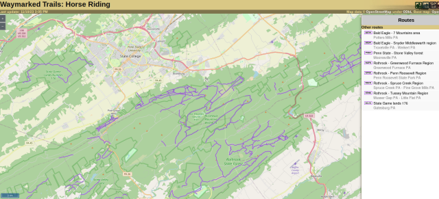
Map of State College Region
We have a useful map that shows many public horse riding trails around State College…
Some suggested destinations include:
- Moshannon State Forest (Black Moshannon park) – trail guide
- Wopsononock Tract – trail guide
- Lower Rail Trail – trail guide
- Canoe Creek State Park – trail guide
- Quehanna Wild Area – trail guide
- Rothrock State Forest – many different regions
- Bald Eagle State Forest – many different regions
- Penn State’s Stone Valley Forest – select forest roads
- Tuscarora State Forest – Lewistown area