If you’re looking for horse riding trails close to State College and Penn State (PSU), this page has ideas of trails and places to go, and provide FREE maps and riding guides.
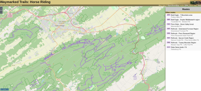
Map of State College Region
We have a useful map that shows many public horse riding trails around State College…
Map of State College area horse trails ![]()
You can also use gpx.studio to map your own riding routes, for free!
Best horse trail riding destinations around State College include:
- Moshannon State Forest
- Black Moshannon park area – trail guide
- Wopsononock Tract – trail guide
- Scotia Game Lands 176 – trail guide
- Rothrock State Forest
- Musser Gap – trail guide
- Greenwood Furnace region – trail guide
- Trough Creek region – trail guide
- Lower Rail Trail – trail guide
- Canoe Creek State Park – trail guide
- Quehanna Wild Area – trail guide
- Prince Gallitzin state park – trail guide
- Bald Eagle State Forest
- Seven Mountains region – trail guide
- Central Mountains region – trail guide
- Penn State’s Stone Valley Forest – select forest roads
- Tuscarora State Forest – Lewistown area
- State Game Lands 321 (Pottersdale)
- Sproul State Forest
All are within 75 minutes of State College when towing a horse trailer.
Our linked trail guides provide detailed, specific information about what you can expect at each location.
State Game Lands 33, along Rt 322 west of State College, CLOSED to horse riding with no warning in fall 2024 and riders were fined, despite the fact that the PGC website said there were 18 miles of trails open to horse riding. DO NOT RIDE THERE.