While this site is mainly about horse trail riding in Pennsylvania, we’ve added many West Virginia horse trails into OpenStreetMap. These can be viewed (for free!) using several methods:
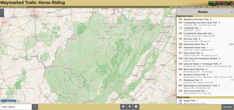
Waymarked Trails: West Virginia ![]()
You can also use gpx.studio to easily view horse trails and create your own riding routes… FREE and no sign-up crap.
OpenStreetMap is often an option for a basemap in many riding and outdoors mapping apps, as well.
We added most of the West Virginia State Park and state forest trails a few years ago. In 2025 we added a large number of rail trails that allow horses in West Virginia, as well as trails in National Forests. We will be working on other areas in 2025 as time permits. Of course YOU can join OpenStreetMap ![]() for free and contribute and improve trails you know too!
for free and contribute and improve trails you know too!
Please be aware, some trails in West Virginia are extremely rugged, with extreme rocks and dramatic elevation changes. Farriers, vets, and emergency medical services can be difficult to reach, and communications (e.g. cell phones) can be useless in areas. Please take appropriate precautions and seek local advice before riding challenging trails in West Virginia!
If you are up for the challenges of trail riding in West Virginia, you can view and download horse riding trails easily and for free using the tools listed above…