While poking around for new places to ride horses in Central Pennsylvania, I stumbled upon Clearfield county’s visitor website ![]() , which mentions Wopsononock Natural Area for horseback riding. Familiar with “Wopsy” mountain outside Altoona, I had never heard of this area… and don’t natural areas prohibit horses?
, which mentions Wopsononock Natural Area for horseback riding. Familiar with “Wopsy” mountain outside Altoona, I had never heard of this area… and don’t natural areas prohibit horses?
Digging revealed this is former Camp Wopsononock, a Scout camp until the county turned it over to DCNR ![]() in 2016. Articles describe it as 578 acres of high-quality woodlands. It does look like a beautiful piece of mature woodland.
in 2016. Articles describe it as 578 acres of high-quality woodlands. It does look like a beautiful piece of mature woodland.
Unfortunately there isn’t much information about the tract online, and descriptions of it are vague and misleading, so I thought I’d share information as I piece it together.
Getting There
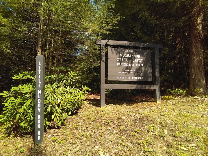
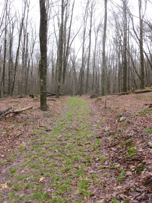
The entrance to the property is Little Muddy Run Road off of PA 253. According to the sign, it is the Wopsononock Tract. Nothing about a natural area.
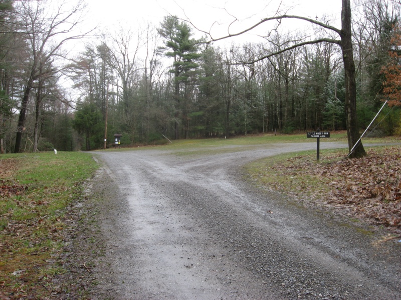
Just off PA 253 there is a decent size grass/gravel parking area large enough for several trailers, though it’s on a bit of a slope. There is some grass for nibbling. The south loop of Dawn Trail heads right off this lot. If you stay straight on the road it takes you to the north loop of Dawn Trail.
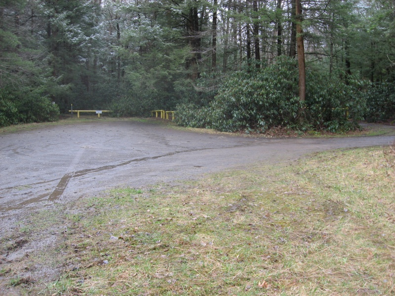
If you drive straight in on the road about 1/4 mile, there is another lot off to your left before the yellow gate. It’s a little smaller and a little tighter access, but flat. You could fit more than one small trailer, but turning around may be an issue.
Nearby Little Muddy Run can supply water for horses but there is no running water and are no facilities for humans, just parking lots! There is plenty of shade.
Note: Do not turn in at Williams Road (north of Little Muddy Run) as this quickly dead ends at a fenced pond and there isn’t much space to turn around. DCNR news claims there are picnic tables here somewhere but I did not see them.
Wopsononock Tract Location:
- On PA 253
- just northeast of village of Allemans
- at Clearfield/Cambria county line
- Gulich township
- 12 miles from Tyrone
Directions from Tyrone:
- take PA 453 (Janesville Pike) west from Tyrone about 11 miles
- turn left on PA 253 and go about 1 mile
- entrance road is Little Muddy Run Rd on left (East) side
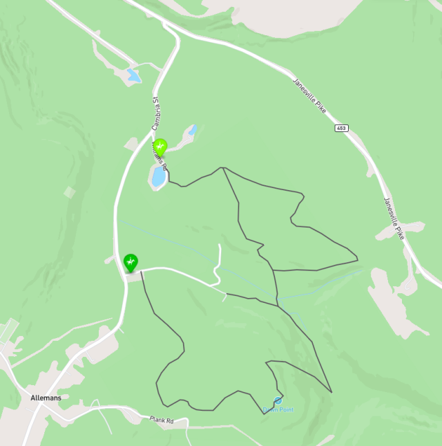
Horse Riding Map of Wopsononock Tract
We’ve created a custom online map using Mapbox that shows the horse riding trails in this area.
Mapbox – Wopsononock Tract Horse Riding ![]()
We’ll try to get this map updated in 2024 to correctly show the water crossings discussed below.
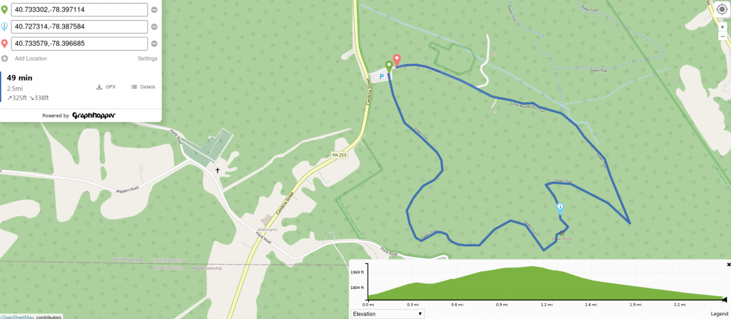
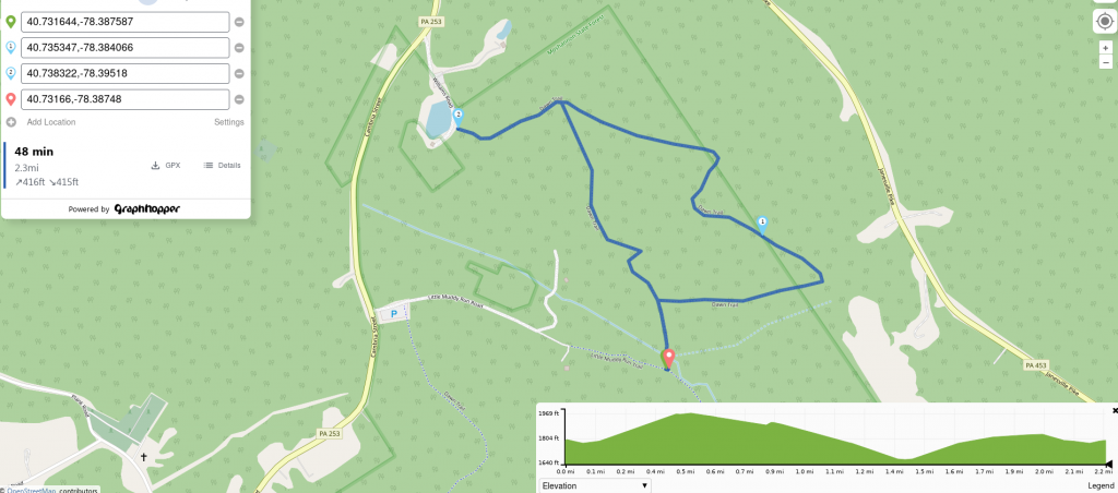
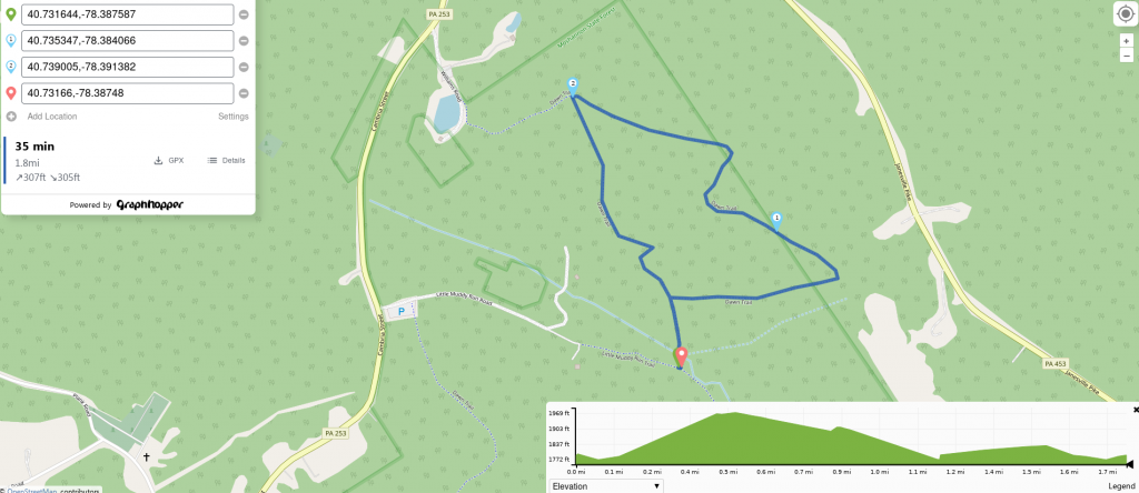
Trail Profiles
We added profiles of the trail loops so you can see distance and elevation profile for each.
Click on image for large version!
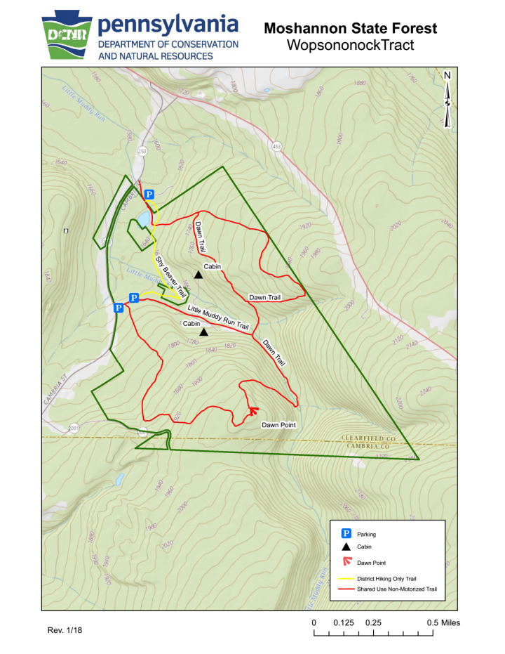
Trail Map
In 2022 DCNR came through with an official map.
Online info suggests that neighboring private property owners are not particularly friendly, so please try to adhere to the trails and boundaries shown.
You can download the map as a pdf file to print or take along (1.2MB).
Water Crossings
The tract is headwaters for streams which feed into a water supply reservoir, so as you might guess it can be a bit wet. The ranger who got me the official map said they “needed to add some bridges” at stream crossings.
I visited in April 2024 after several days of rain and found water crossings on Dawn Trail (both north and south loops) were too deep and fast for me to deal with at 37F with intermittent snow showers! The woods was pretty barren, but you can see it’s nice mature forest. Will be great in summer.
Where Dawn Trail turns north off Little Muddy Run Trail (road), there is one crossing. Per the map there may be another one ahead.
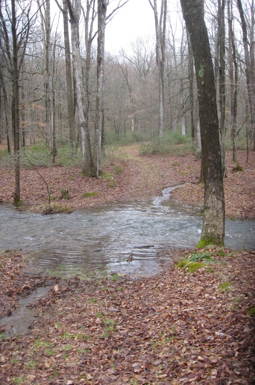
If you continue ahead onto the southeast curve of Dawn Trail (taking the south loop clockwise) you reach another water crossing (not shown correctly on map) which blocked that route. There must be another crossing farther up the stream before you switchback up the hill.
You can’t just stay on this side of the stream and reach the switchback up the hill, as the hillside gets quite steep next to the stream.
Granted, we had a lot of rain, but these water crossings are worth knowing about before you visit. Unless your horse is a real water bug, it may be best to avoid these trails after a lot of rain.
Trail Notes
Both loops of Dawn Trail are multi-user so you may encounter bicycles and hikers. I pass the parking area fairly often to ride at Prince Gallitzin and have never seen anyone parked there, so usage is probably minimal.
Please note that areas of Dawn Trail look a little steep. Based on the map contours, they could be 10~15% grade.
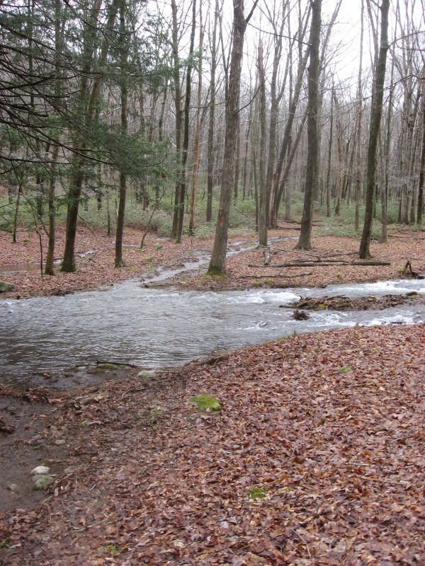
The south loop of Dawn Trail heads off the main parking area. It’s a double track trail climbing through mature woods, with a mix of dirt and rounded rocks.
The other end of Dawn Trail’s south loop. This is near the water crossing on Little Muddy Run.
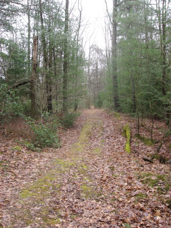
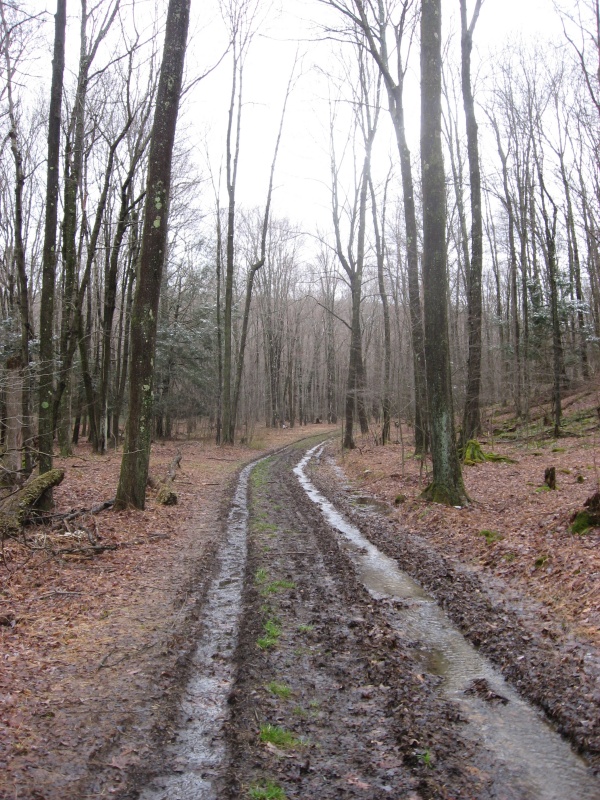
Little Muddy Run trail is really just a gated road back to a couple camps. It was quite muddy and rutted when I visited after all the rain, but you could skirt most of the water and mud by using the shoulders.
Spring
While riding, see if you can spot the big spring with its little wooden bridge and a stone monument to the family which donated this property to the Scouts.
Updates
2024.04.05 - added trail pics and water info
2024.03.02 - added trail profiles